Summary
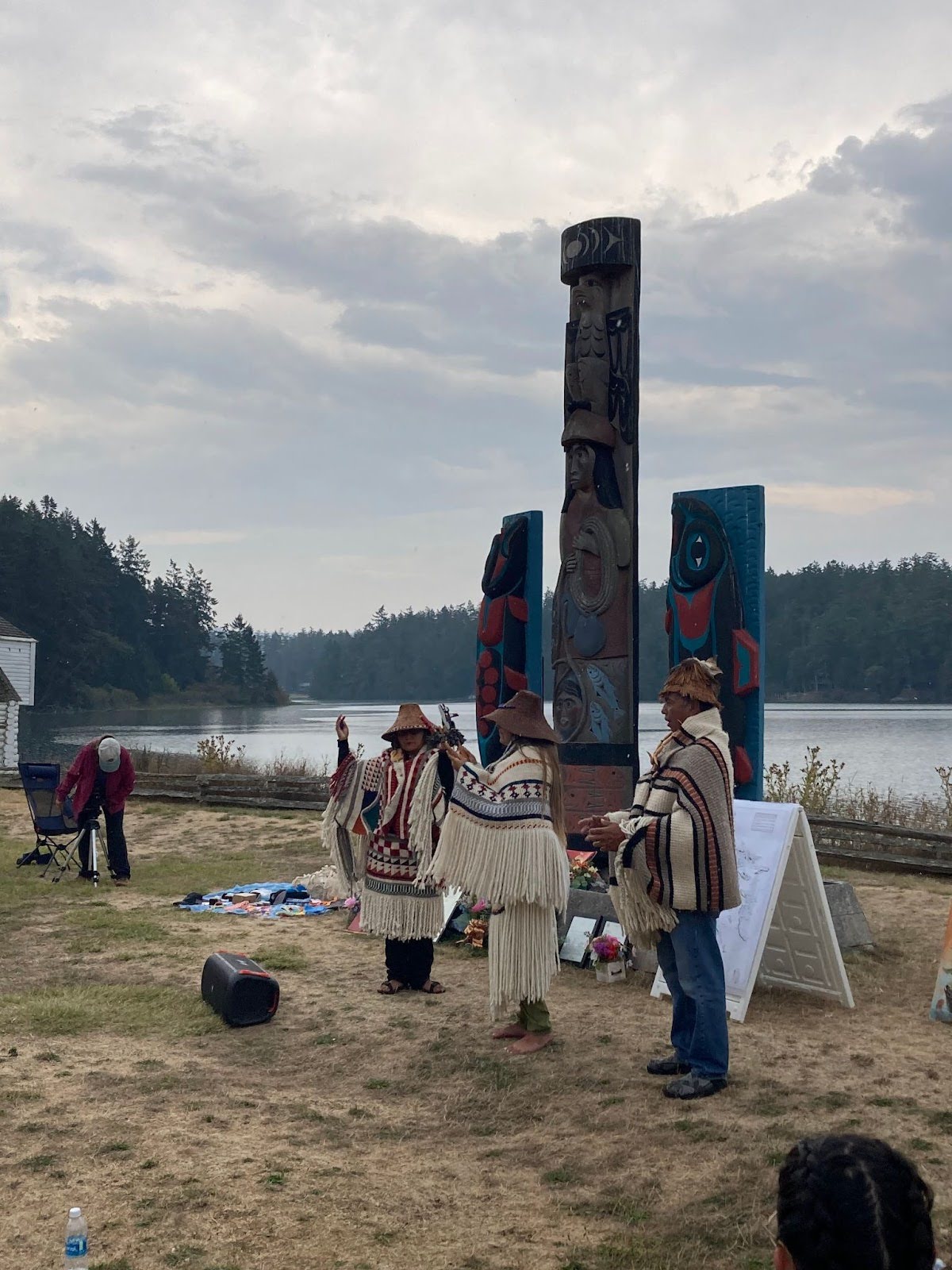
The Transboundary Gathering: Digital Ecocultural Mapping in the Salish Sea was an Indigenous-led collaborative working meeting and coalition-building event that took place in August 2023 on the ancestral land of the Indigenous Lummi people in Washington State. This 5-day gathering took place under the leadership of Kusemaat (Shirley Williams) and Whiteswan Environmental, who are located in Lummi territory, Washington State, with the support of the American Indian Higher Education Consortium (AIHEC), Western Washingon University’s Centre for Community Learning, the Institute for Multidisciplinary Ecological Research in the Salish Sea (IMERSS) and OCAD University’s Inclusive Design Research Centre (IDRC). The gathering brought together over 100 Indigenous and non-Indigenous researchers, designers, students, and government officials from Canada and the U.S. to consider approaches to ecocultural mapping that are rooted in the land, respect cultural safety, address issues of data sovereignty, protect sacred knowledge, and ensure Indigenous leadership.
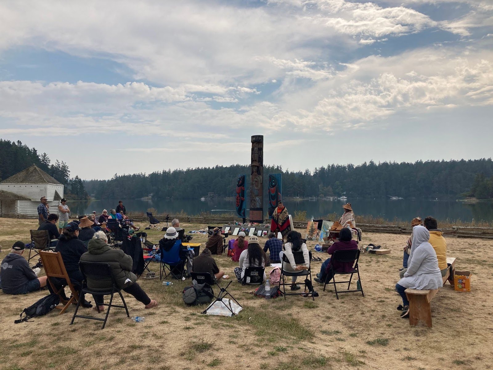
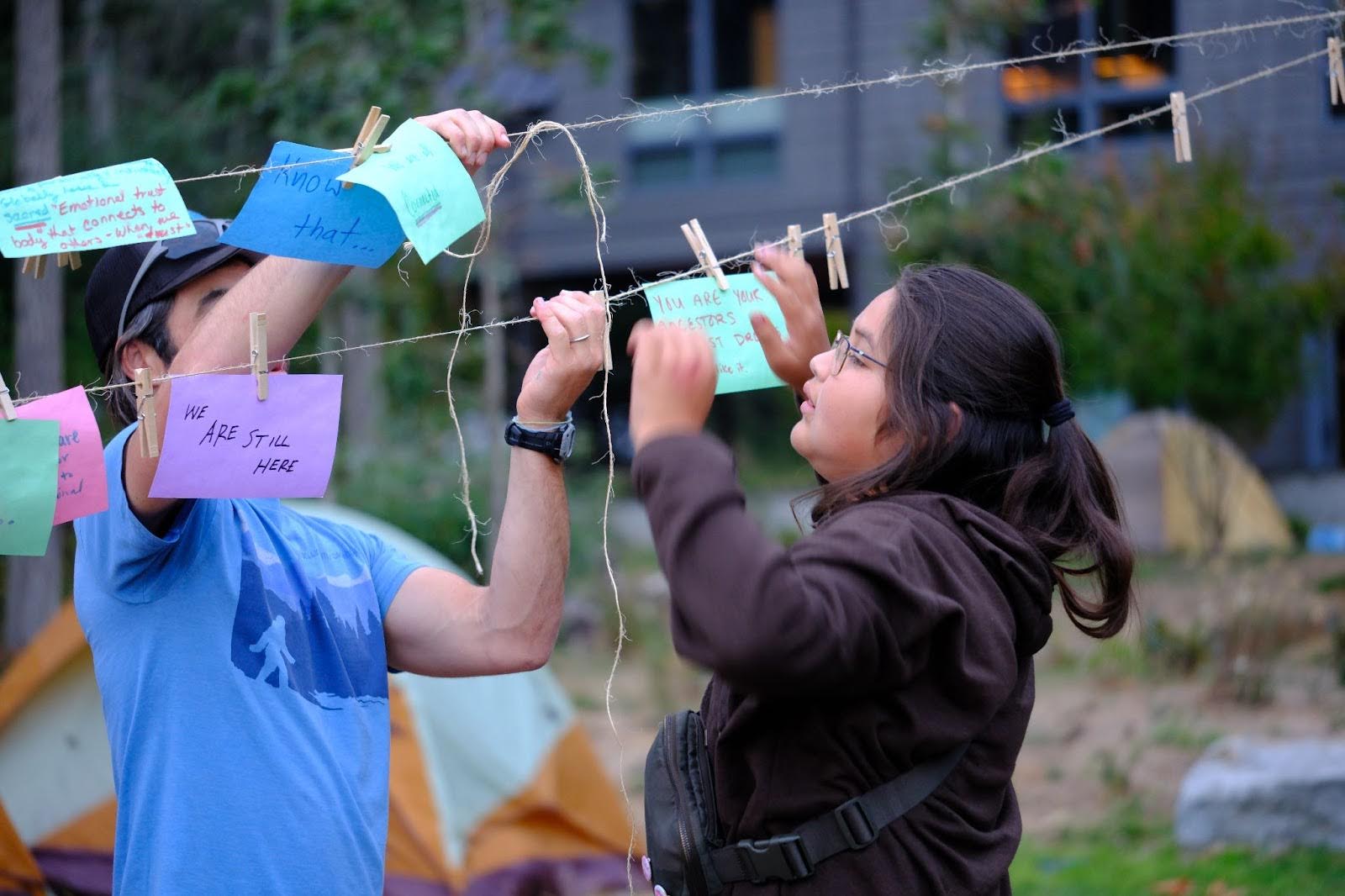
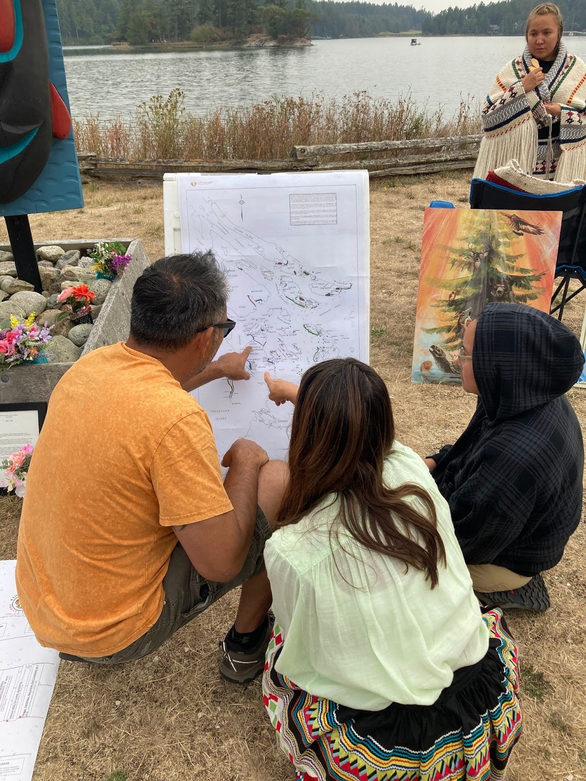
The gathering included structured conversation and discussion through facilitated social learning circles and community-led design sessions, singing, storytelling, tours of the land and site visits. Participants engaged in activities at multiple locations including two ancestral village sites and the Lummi reservation. Visiting locations central to the present-day lives and rich ecocultural heritage of the Lummi people helped to facilitate a deeper understanding of the impact, benefit and challenges of ecocultural mapping in this region and beyond.
Ecocultural Mapping
The impetus for this gathering was an interdisciplinary, participatory and inclusive digital mapping project that began in 2020. Digital ecocultural mapping can provide visualizations and storytelling about natural, cultural, and historical sites including ancestral village sites, camps, reef net locations, food sovereignty, biodiversity and Indigenous stewardship systems. The pilot project of the ecocultural story map aims to meaningfully braid together Indigenous ways of knowing and ecological science to create an interactive, educational, ecocultural map of a region in the Salish Sea called Xetthecum in the Hul’q’umi’num’ language (Retreat Cove, Galiano Island, BC).
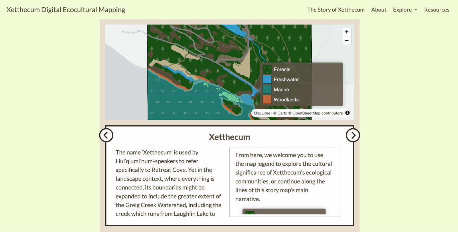
This digital ecocultural storymap and accompanying website will serve as an educational resource supporting Indigenous youth and others to learn the Hul’q’umi’num’ language, study the regional biodiversity and ecological communities in which different species live, and learn about the ecological and cultural values of those species and communities. The storymap also aims to promote ecocultural mapping as a professional conservation practice among the next generation of land stewards. The Transboundary Gathering provided an opportunity for the coalition, together with a broader audience, to co-create next steps for a broader mapping initiative that would include the mapping of Pe’pi’ow’elh (English Camp) in Lummi territory.
Relationship Building and Knowledge Sharing
The starting point for this digital ecocultural mapping project was the preservation of biodiversity in the Salish Sea, a region that spans the colonially-imposed boundary between Canada and the US (Sobocinski 2021). Transboundary relationships are essential for the success of this work; the colonial fragmentation of Indigenous tribes caused by enforcement of the Canada-US border has created a barrier to the knowledge sharing and collaborative solution-building essential to restoring Indigenous language, culture and lands (Norman 2012; Wilson 2019).
The Transboundary Gathering acted as a catalyst for establishing an on-going collaborative partnership to support cross-cultural ecocultural mapping efforts in the Salish Sea region, and to share tools and resources that will support similar efforts elsewhere. Together with Indigenous and non-Indigenous designers, scholars and technologists, we explored the implications of co-design and interdisciplinary knowledge exchange among Indigenous communities, bioscientists, ecologists, and inclusive designers. Building on the development of community-led co-design methods, the gathering provided an opportunity for workshop participants to extend and apply these practices to address the challenges of cross-cultural collaboration and to consider how an inclusive design approach can help to reconceptualize the design of technologies and cultural systems in ways that centre Indigenous leadership and epistemology.
Knowledge Mobilisation
Our knowledge mobilization efforts include:
- Presentation of the storymap to Penelakut elders (February 2024, Galiano Island), including gathering feedback and further stories of place for inclusion in the storymap.
- Documentation and sharing of a synthesis of the key practices, plans, and actionable approaches for ecocultural mapping research, including lessons learned.
- Creation of a website that provides an engaging and accessible portal into the project and the storymap.
- Dissemination of design prototypes of digital ecocultural mapping tools (Xetthecum, Pe’pi’ow’elh) that are being shared through partners’ established networks (IMERSS, CRD, IDRC, Watersheds BC).
- Presentation of the project at the Indigenous Watersheds Initiative gathering (March 2024).
- Presentation to the public and to National Parks Services at Pe’pi’ow’elh (English Camp), San Juan Island (August 2023).
- Documentation and sharing of research practices for cross-cultural, Indigenous-led projects, including by-laws and community-led design strategies (WIP).
- Presentation of the Xetthecum project at Biosonic (Galiano Island, March 2023 & 2024).
- Sharing of Xetthecum Storymap work with the broader inclusive design community through the FLOE project and WeCount Recount newsletter.
- Presentation of the digital ecocultural storymap with Data Communities for Inclusion August 2023 CIFAR solutions network meeting in context of data sovereignty and data governance.
Upcoming:
- Presentation of the Xetthecum storymap to community members on Galiano Island in an exhibition format that will allow for discussion and input (Yellowhouse Art Centre, October 2024).
- Inclusion of the ecocultural storymap and Transboundary Gathering footage in Parallax: Reimagining the Canada-U.S. Border Venue: The Reach Gallery Museum (April 4 – August 16, 2025); touring to additional exhibition venuesin British Columbia Washington State in 2026 pending confirmation.
References
Norman, E.S. 2012. “Cultural politics and transboundary resource governance in the Salish Sea.” Water Alternatives 5 (1): 138-160. [https://www.water-alternatives.org/index.php/allabs/162-a5-1-9/file].
Sobocinski, Kathryn L. 2021. “State of the Salish Sea”. Institute Publications, Salish Sea Institute, Western Washington University. [https://doi.org/10.25710/vfhb-3a69].
Wilson, Kyla. 2019. “Governing the Salish Sea.” Hastings Environmental Law Journal 26, no. 1 (Winter): 169-182. [https://repository.uchastings.edu/hastings_environmental_law_journal/vol26/iss1/9/].